By QUINTON SMITH/YachatsNews.com
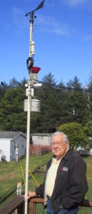
Donald Tucker relies on an automated station to take weather readings and an antenna on his roof to every five minutes transmit data that ends up in a national data center in Utah.
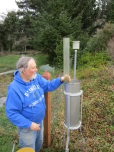
Kirk Walker does it the old fashioned way. Each morning at 8 o’clock he goes out to hand-measure rain in a big metal gauge, record the current temperature, pencils it on a chart and then loads it on a data sheet used by the National Weather Service office in Portland.
Although the Yachats men use different methods, they are part of human networks that help Oregon forecasters predict and track the weather – and try to warn us when something bad might happen.
The National Weather Service has satellites in the sky, radar on mountaintops and buoys at sea to help it forecast and record the weather. But is also relies on networks of people on the ground – weather watchers – to let them know what happened all over Oregon.
Tucker and Walker are two of them.
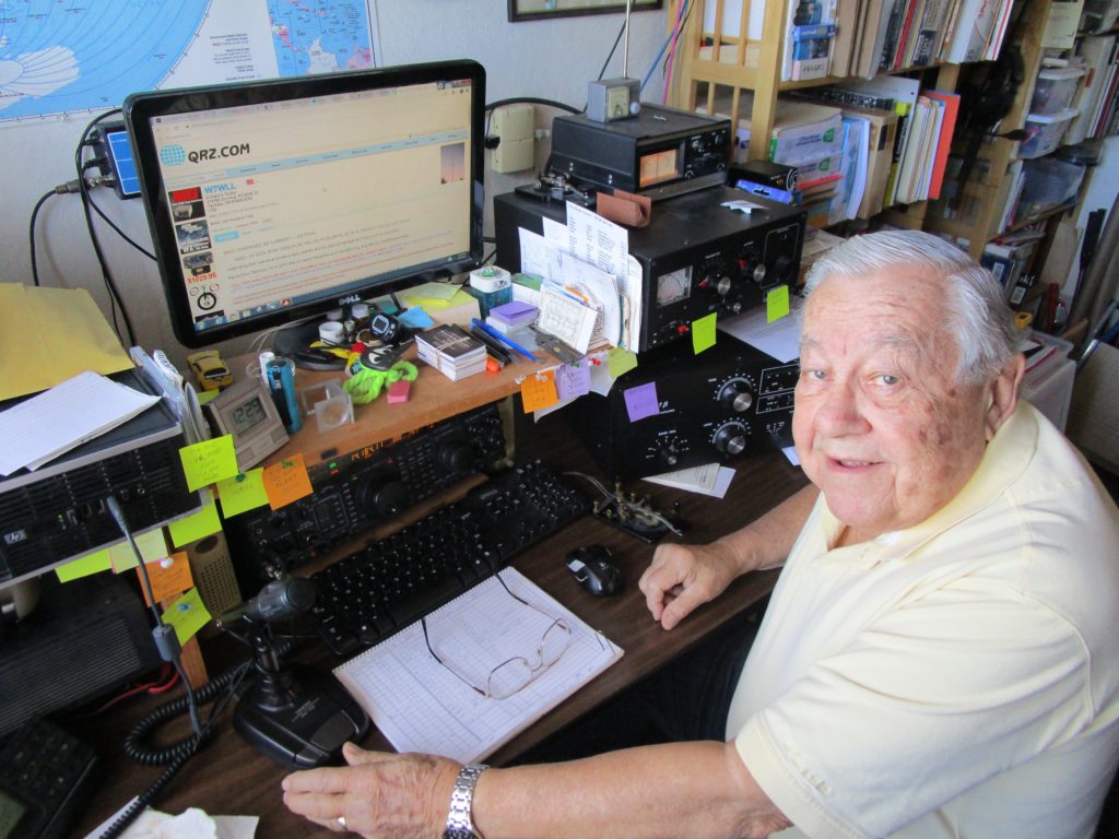
“I’ve always had a general interest in the weather,” said Tucker, who has been living just north of Yachats with his wife, Judi, since 2003. He was a longtime executive at Tektronix, Oregon’s first major electronics company, and is an amateur radio operator with a 1,000-watt license.

Tucker has the southernmost weather station for an organization of ham operators called the Oregon Coast Repeater Group. His information – temperature, rain amounts, humidity and wind direction and speed – goes to a computer at Otter Crest which then sends it to Mesowest, a program at the University of Utah. Mesowest, which has 20,000 reporting stations across the United States, shares it with the National Weather Service to provide current conditions around the country.
Walker has three science degrees and worked for the California State Lands Commission in Sacramento before moving to Yachats in 2001 with his wife, Joy. Weather has always been an interest, he said, even more since moving to the Oregon Coast.
“I spent some time out of college as a pilot, so weather was important,” he said. “I’ve always been interested in the weather and I’m curious.”
How the NWS uses weather watchers
The Portland office of the National Weather Service is one of 122 across the county. Its 16 forecasters are responsible for weather and river forecasts and information for southwest Washington and western Oregon. Other NWS offices are in Medford and Pendleton. Its radar stations are located near Scappoose, Aberdeen, Wash., Pendleton and on Mount Ashland. It’s also plugged into a just-launched satellite designed to give it better information along the West Coast.
But it needs “eyes in the field,” says NWS hydrologist Andy Bryant, to verify forecasts and alert the agency to dangerous conditions.
The NWS has 1,500 spotters in Oregon and southwest Washington who are members of its “Skywarn” program. Some 50-100 of those are in Lincoln County.
The purpose of the Skywarn program for Oregon weather watchers is to call or email the Portland office when they see extreme weather that could be a threat to life or property.
That includes:
- Tornado, funnel cloud or water spouts;
- Hail larger than a dime
- Sustained winds of 40 mph and gusts over 55 mph
- Heavy rain of a half-inch within one hour or an inch within 12 hours
- Flooding rivers
- Dense fog near zero visibility
- Snow of more than one inch in the Willamette Valley or coast; four inches at higher elevations
- Freezing rain and sleet
- And, heavy surf or coastal flooding
“We do genuinely depend on weather watchers,” Bryant told a Lincoln County group late last year during a recruitment meeting. “We do have a lot of real cool high-tech stuff … but they don’t always tell us what’s happening on the ground.”
For example, he said, the October 2016 tornado that hit Manzanita was the first time the NWS’ Portland office issued a warning in advance of the incident. The highest official wind speed measured in Lincoln County was during a December 2007 storm when it hit 125 mph. Seas reached 48 feet before a weather buoy broke its mooring.
Generally, Bryant said, Oregon is “seeing more extreme patterns of weather for longer periods of time.”
The weather is better here
Tucker does more than track weather, however.
His first love is ham radio (“That’s how I got my job at Tektronix.”) and has had a license since 1954. Each day he uses his powerful radio to listen in or talk to other ham operators around the globe. This week Tucker (his call sign is W7WLL) talked to a Russian visiting an island in the Indian Ocean.
He also has an antennas and equipment that tracks commercial airplane flights (FlightRadar24.com) along the West Coast and ships at sea (MarineTraffic.com) out to 1,000 miles. His equipment sends those streams of data to central tracking computers in Europe.
But two or three times a day he will look at his weather instruments “just to get an idea of what’s going on at the beach.”
Tucker and Walker say the Yachats area has interesting weather patterns – and more sun — mostly because it is in the “shadow” of 800-foot high Cape Perpetua jutting out into the ocean.
“There’s a big difference between the weather here and in Waldport,” Tucker said. “People say, ‘Oh, it’s the same.’ But it’s not. We get a lot of good weather here.”

Walker said there is a wind tunnel effect from the Yachats River north to the Fireside Motel. And those frequent east winds in the morning come from cold air up the river valley being pushed out and over Horizon hill.
As a Skywarn participant, Walker said he spotted a funnel cloud over the ocean during his regular morning walk on April 8, 2007. His highest rain total in one day – 6.89 inches – was on Nov. 7, 2006. Three or four times a year he’ll record wind at more than 70 mph; a 107 mph reading was his highest.
If he misses sending information to the weather service in Portland, someone will call to check on him.
“I love living in a place that has interesting weather,” he said. “It just changes from minute to minute.”
And both men say there’s little debate in their minds, based on their more than 10 years of recordkeeping, that temperatures along the coast are rising slowly and rainfall is decreasing.
“Each year it’s not quite a 10th of a degree (on average), but it is noticeable,” said Tucker, who is also chair of the Southwest Lincoln Water District that has 1,400 customers between Yachats and Waldport. “And rainfall is trending down.”
Related Links:
Current weather from Oregon Coast Repeater Group: http://www.ocrg.org/telemetry_feed/ocrgwx.html
QRZ.com: A website for amateur radio operators that registers almost every ham operator call sign in the world.
FlightRadar24.com: A flight-tracking service that provides real-time information on thousands of aircraft around the world.
MarineTraffic.com: an open, community-based project providing real-time information on the movements of ships around the world.


