By QUINTON SMITH/YachatsNews.com
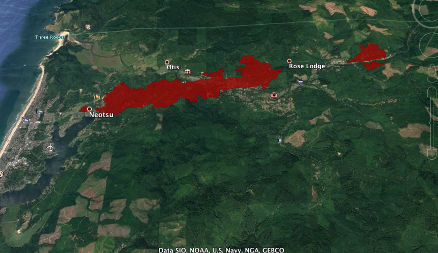
The two fires burning along Oregon Highway 18 east of Lincoln City doubled in size to 2,400 acres Wednesday and reached the north edge of the city, but fire crews hope Thursday to begin attacking the blaze as weather improves and they finish evacuating people from homes in the fire’s path.
There are just 100 firefighters — local and from the Oregon Forestry Department — and no air tankers or helicopters battling the blaze because massive fires near Estacada, in the Santiam Canyon, along the McKenzie River and near Medford have stretched all firefighting resources thin across Oregon.
“Normally a 2,400-acre fire is a big deal, especially on the west side,” said Ashley Lertora, a spokeswoman for the Oregon Forestry Department. “But the others are mega-fires.”
The agency is getting help Thursday from a small incident management team flying in from Florida, she said.
Strong east winds that raked the area earlier in the week died overnight and Thursday there were light winds from the south/southwest that could help the fire stop advancing to the west.
“We finally have most people out of the way,” Lertora said. “Today maybe we can really get in there and attack the fire.”
But neither Lertora or Lincoln County emergency management officials have information on the number of homes and other structures destroyed by the Echo Mountain and Kimberling fires, which are burning on both sides of Oregon 18 from Otis to Rose Lodge. County officials said it could be as long as five days before detail damage information is available.
But residents of the area who are posting video on Facebook pages are showing fires sweeping through whole neighborhoods. Another man who evacuated his parents from their house along Highway 18 told YachatsNews that hundreds of homes have burned.
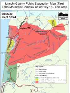
Residents and businesses in parts of Lincoln City, Otis and Rose Lodge were evacuated Tuesday and Wednesday as strong east winds whipped the main fires and started spot fires on the north edge of Lincoln City near the Chinook Winds golf course. Wednesday afternoon, Lincoln County more than doubled the size of the evacuation area east of Lincoln City and along Oregon Highway 18 near Rose Lodge.
An evacuation center was initially set up at Chinook Winds Casino in Lincoln City but had to be moved to Oregon Coast Community College in the South Beach area of Newport after the area around the casino was also ordered evacuated. Wednesday evening the American Red Cross moved the site to the Newport Recreation Center, where 223 people spent the night.
The county staged buses at the Lincoln City Safeway store and the Lincoln City Community Center to help get people out of the area.
Residents of at least one assisted living center in the north section of Lincoln City were taken to the Shilo Inn in Newport, where they were being sheltered. The Newport Chamber of Commerce was asking for community help to feed them.
Wednesday morning people reported panicked drivers trying to get south through Lincoln City on Wednesday, with horns honking, driving on sidewalks and going the wrong way down streets.
The Oregon Department of Transportation closed U.S. Highway 101 for through traffic from Gleneden Beach north to its junction with Oregon Highway 18. Barriers and flaggers were in place to allow people to evacuate. State and local officials urged travelers to avoid the area as they would not be allowed through.
Reports had traffic on Highway 101 between Newport and Lincoln City at a standstill much of the day. By nightfall the highway through town was deserted.
If there was good news Wednesday it was that by evening light winds were shifting to come from the southwest, temperatures dropped quickly and humidity rose. Winds were expected to be light Thursday in Lincoln County but gradually shift to west/northwest, which would drive smoke east and possibly slow the march of any fires.
Nine patients and staff from Samaritan North Lincoln Hospital were evacuated Wednesday morning and taken to its sister hospital in Newport.
The Lincoln City evacuation ordered by the Lincoln County Sheriff’s Office initially covered homes and businesses from Northeast 40th Street – which is near the Safeway on the north side of town – all the way to Otis. It included all of the homes on East Devils Lake Road. The evacuation area expanded throughout the day Wednesday.
Strong winds whipping two fires burning on both sides of Highway 18 between Otis and Rose Lodge were causing the problem.
The Echo Mountain and Kimberling fires were burning 1,000 acres on the north side of Highway 18 on Wednesday. On Tuesday the Kimberling fire was just 120 acres and the Echo Mountain fire 46 acres.
The Echo Mountain fire, which is burning closest to Rose Lodge, jumped to the south side of the highway Wednesday, said Ashley Lertora, a spokeswoman for the Oregon Forestry Department.
It was burning southwest toward Lincoln City setting a spot fire near the casino’s golf course, which prompted the county’s evacuation notices.
There were individual reports of homes and buildings in Otis destroyed by the fires, but no official confirmation. “I don’t think anyone has time to count,” Lertora said.
The Kimberling fire is burning between mileposts 3-4 on Highway 18.
Lertora said there were an estimated 100 firefighters from the agency and local fire departments battling the blaze.
“Last night it grew a lot,” Lertora said.
“Fire fighting resources are stretched thin and it will take up to 48 hours to assess what damage occurred last night,” Lertora said. “Firefighters are working in a very dynamic situation under sustained east winds. Their priority is public and firefighter safety while providing structure protection.”
A spokeswoman for Samaritan Health Systems said the Lincoln City hospital cancelled outpatient treatment Tuesday and decided Wednesday morning to move nine patients who were in the hospital for longer-term care. Its clinics in Lincoln City are also closed.
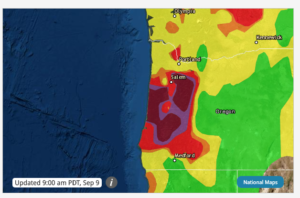
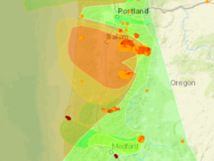
Smoke from forest fires in Lincoln County and the Oregon Cascades reached “hazardous” levels throughout the county again Wednesday after winds Tuesday downed trees, power lines and pushed fires into tinder-dry forests and some neighborhoods. People were urged to remain indoors and limit their activity.
Lincoln County commissioners declared a state of emergency Tuesday after the unusual summer windstorm knocked out power, closed some roads and ignited the fires near Otis and east of Waldport.
Wednesday morning, Lincoln County officials were ordering the evacuation of northern sections of Lincoln City along East Devils Lake Road north of the outlet malls to Oregon Highway 18. The Oregon Department of Transportation shut U.S. Highway 101 from Gleneden Beach through Lincoln City to its junction with Highway 18. It asked that people avoid the area and leave the road open for evacuation and response crews.
Highway 18/Salmon River Highway is closed from U.S. 101 for seven miles to Rose Lodge.
On Wednesday, Oregon State University said it was closing its Hatfield Marine Science Center and Extension offices in Newport until further notice.
The Lincoln County School District announced there would be no work Thursday and Friday for district employees. “Stay home and care for your families and for yourselves,” Superintendent Karen Gray said in a districtwide email.
Members of South Beach Church in Newport served meals to evacuees Wednesday night, and were making plans for meals the rest of the week.
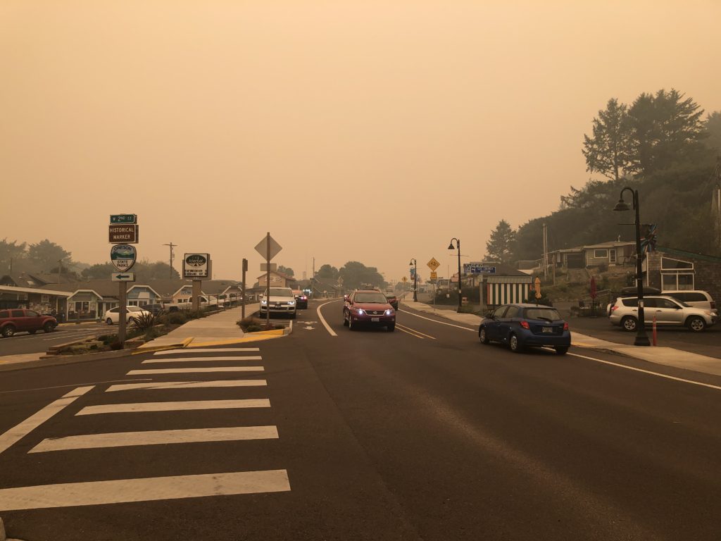
Winds reached 55 mph Tuesday
Winds that reached 55 mph Tuesday morning knocked out phone service, power and internet service to much of south Lincoln County. Most service as restored Tuesday night.
In Yachats, the Quiet Water subdivision and most Central Lincoln Peoples Utility District customers south of the Yachats River bridge lost power when the storm hit about 10 p.m. Monday. Several large trees went down there as well.
A spokesman for Lincoln County said at one time Tuesday there were 10,000 people without power countywide.
U.S. Highway 101 about one mile south of Yachats was closed when at least two large trees went down across the highway. The road was cleared by noon.
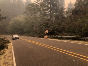
Trees were knocked down in the Cape Perpetua campground, forcing its closure. The U.S. Forest Service also closed access to the Cape Perpetua Visitor Center parking lot and trail heads and closed off Devil’s Churn.
A down power line sparked a small fire at Reeves Circle and Highway 101 on the south edge of Yachats, which was quickly extinguished early Tuesday by Yachats Rural Fire Protection District crews. It was re-ignited when power was restored and put out a second time.
“There were lots of limbs and trees down and lots of lines down,” said Shelby Knife, administrative assistant for the fire district.
In downtown Yachats, several businesses lost picture windows and the high winds destroyed a temporary shelter over picnic tables at the Luna Sea restaurant.
Highway 101 north of Depoe Bay was closed early Tuesday due to downed trees and power lines, then re-opened to one lane of traffic later in the day.
A small fire that threatened three structures four miles east of Waldport along Highway 34 was extinguished quickly Tuesday morning.
The Lincoln County School District cancelled all teacher preparation and other school-opening activities Tuesday and again for Wednesday.
But it was the smoke from a larger fire near Alsea, the fires near Otis, and a massive blaze in the Santiam Canyon east of Salem and a devastating fire east of Eugene along the McKenzie River that blanketed the central Oregon Coast throughout the day Tuesday and Wednesday. Visibility at times was down to 200 yards or less. The smoke stretched hundreds of miles out to sea.
Cars drove with their headlights on. Tourists stopped by the Yachats fire station wondering what was going on or if they should evacuate. White ash from the fires fell softly as the wind died and smoke enveloped the town.
The National Weather Service said Lincoln County should expect another smokey day Wednesday, with more east winds pushing smoke to the coast. Southwest and then westerly winds were predicted to clear the air on Thursday.
Links to information and resources you can explore yourself
Air quality in Yachats (or your local area) from AIRNOW.gov
Oregon fire and smoke interactive map: The Statesman-Journal newspaper in Salem has a map updated hourly.
The National Weather Service forecast for the central Oregon coast.
The Lincoln County Sheriff’s emergency management website
Complete fire reports from throughout the Northwest from the Northwest Interagency Coordination Center
Oregon Office of Emergency Management dashboard on current fires
Link to OregonLive’s Wednesday morning fire news
Oregon road closures, warnings from the Oregon Department of Transportation
Central Lincoln PUD’s map of electrical outages
People who evacuate can register as safe or check on people who registered as safe here
Gov. Kate Brown says fires ravaging Oregon could be most destructive in state history
By GARY A. WARNER/Oregon Capital Bureau
Oregon is being swept by likely the most deadly and destructive fires in its history, Gov. Kate Brown said Wednesday.
“I want to be upfront with Oregonians,” Brown said. “This could be the greatest loss of life and structures due to wildfire in state history.”
As of noon Wednesday, 47 active fires covering 374,522 acres were burning in Oregon, according to the Oregon Office of Emergency Management.

Hundreds of homes have been lost and there have been thousands of evacuations across the state as fires, fueled by strong winds and hot, dry conditions, have broken out everywhere in Oregon.
Brown said the communities of Detroit in Marion County; Blue River and Vida in Lane County; and Phoenix and Talent in Jackson County are “substantially destroyed.”
State officials said they had no number yet on casualties, but they were expected. Mortuary units from the Oregon National Guard are being activated.
The fires continue to burn largely unchallenged as firefighters concentrate on evacuating people to safety.
“We are having limited success,” said Doug Grafe, with the Department of Forestry. “Most I would put at zero percent containment.”
Brown said that towns along the western facing valleys of the Santiam River, McKenzie River and Rogue River had been destroyed.
The largest blaze is the Santiam/Beachie Creek Fire, at 132,450 acres burned east of Salem. It is zero percent contained. The Lionshead Fire has burned 109,222 acres. Fire officials said they expected the fires in the Santiam River area to combine into one large blaze
About 3,000 firefighters are deployed.
“I would expect that to scale up over next 24 hours as we get on the offense on these fires,” Grafe said.
But reinforcements are not plentiful because of fires across the western United States are breaking out at the same time.
“The national system is absolutely strained,” Grafe said. “We have to work with what we have.”
Much of eastern Lane County has been under evacuation orders because of the Holiday Farm Fire. Residents in Leaburg, Walterville, Camp Creek and portions of the Mohawk Valley were ordered to leave. In Marion County, Scott’s Mills, and Stayton remain under Level 3 “go now” evacuations. Sublimity, Aumsville and Silverton are at Level 2 “be ready.”
The Alameda Street Fire reportedly began as a small blaze in grass adjacent to Interstate 5 south of Medford. It burned north, destroying homes and other structures in Phoenix and Talent. All residents of Jackson County are currently under a Level 1 “get ready” evacuation order. A second, smaller fire, was reported in Eagle Point.
Brown pointed to the unpredictability of the blazes as a warning for residents across the state to be ready if evacuation orders are given.
“Fire can be very fickle,” she said, adding that if ordered to evacuate, “please leave — you may not get another chance.”
Fires are also burning on the west side of the coastal range, with evacuations ordered in parts of Lincoln County, including parts of Lincoln City.
The National Guard has been operating seven aircraft to support the firefighting. These include HH-60M Black Hawk helicopters. Two are doing medical evacuation, the rest are firefighting.
Six CH-47 Chinook helicopters with Bravo Company, 1st Battalion, 168th Aviation Regiment had been sent to Afghanistan to support military operations. The Chinooks are normally the largest firefighting helicopter.
Grafe said the state had enough aircraft to meet its needs and that the high winds and dense smoke were keeping many on the ground for now.
Evacuations will continue to be the main focus until at least Thursday.
“Life safety is our number one priority,” said Office of Emergency Management Director Andrew Phelps.
Delaying as fire races toward a community is not an option.
“Once that Level 3 evacuation order comes, you have to get out, there is no time left,” Phelps said.
Red Cross evacuation centers have been set up at Deschutes County Fair & Expo Center in Redmond, Taft High School in Lincoln City, Oregon State Fairgrounds in Salem, Thurston High School in Eugene, Douglas County Fairgrounds in Roseburg and Clackamas Community College in Oregon City.
Brown said state and local officials are working to disperse evacuees and not have them congregate in one spot, due to the COVID-19 pandemic. Red Cross centers are the staging area for relief efforts and evacuees are being urged to register with the Red Cross so that they can be found by friends and family.
Seventeen new large fires started Tuesday, according to the National Interagency Fire Center. Nationwide, 96 large fires have burned more than 3.4 million acres. Just under 2 million acres are burning in California alone.
There is currently an air quality alert for the Oregon Coast, Willamette Valley and Southern Oregon.
Good air quality is reported in Bend, while Moderate Air Quality is reported in Sisters and Madras. Air quality was moderate in locations in Eastern Oregon along the I-84 corridor.


This was the best coverage of the fires in Western Oregon I’ve seen Great Job!!
Excellent coverage! Most thorough one I’ve found.